|
|
|
Tags
top destinations,
monuments in, north east, indian, wildlife, tours, travel, tourist,
guide, attraction, places, tourism, destinations in mizoram,
india,
About
Mizoram, Tourism, Monuments,
Attractions, Travel Tips, Shopping, mizoram travel destinations,
destinations in mizoram, mizoram tourism monuments, tourism
monuments attractions, wealth of flora, flora and fauna,
attraction places tourism, places tourism destinations, hills of
northeastern, variety of landscape, north east indian, monuments
in north, top destinations monuments, the hill ranges,
destinations in india, highest in india, mizos are christians
|
|
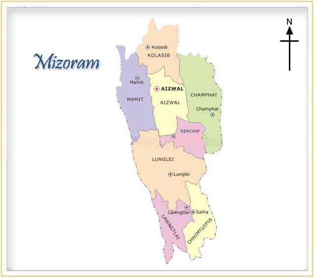
Mizoram
|
|
|
Status: |
North Eastern State of India |
|
Shopping: |
- |
|
History of: |
- |
|
Population: |
11.50 Lac |
Perching on the high hills
of northeastern corner, Mizoram is a storehouse of natural beauty with
its endless variety of landscape, hilly terrains, meandering streams
deep gorges, rich wealth of flora and fauna. Mizoram is situated
between 21-58o to 24o 29' north latitude and 92o 29' to 93o 22' east
longitude. The tropic of Cancer passes near the capital, Aizawl town.
In shape it is rather like a narrow and inverted triangle. It is
bounded on the north by the district of Cachar (Assam) and the state
of Manipur, on the east and south by Chin Hills and Arakan (Myanmar)
on the west by the Chittagong hill tracts of Bangladesh and the state
of Tripura. Mizoram borders three states of India - Assam , Manipur
and Tripura. Its geographical borders with Assam, Manipur and Tripura
extended over 123 km, 95 km and 66 km, respectively. Mizoram, in the
local language, means the land of Mizos. Mizo itself means highlander.
Under the British administration, Mizoram was known as Lushai Hills
district. In 1954 by an Act of Parliament, the name was changed to
Mizo Hills district. In 1972, when it was made into a union territory,
it was named Mizoram. Mizoram became the 23rd state of the Indian
union on February 20,1987. Mizoram occupies an important strategic
position having a long international boundary of 722 Kms.

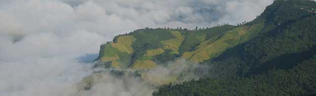
Hills
Mizoram has the most variegated hilly terrain in the eastern part of
India. The hills are steep and are separated by rivers which flow
either to the north or the south creating deep gorges between the hill
ranges. The average height of the hills is about 900 metres. As many
as 21 major hill ranges or peaks of different heights run through the
length and breadth of the state with the highest peak 'Phawngpui (Blue
Mountain) towering 2,065 metres above the sea level. The hills are
extremely rugged and steep leaving some plains scattered occasionally
here and there.
Rivers
Although many rivers and streamlets drain the hill ranges the most
important and useful rivers are the Tlawng (also known as Dhaleswari
or Katakhal), Tut (Gutur), Tuirial (Sonai) and Tuivawl which flow
through the northern territory and eventually join river Barak in
Cachar. The Koldoyne (Chhimtuipui) which originates in Myanmar, is an
important river in the south Mizoram. It has four tributaries and the
river is in patches. The Western part is drained by Karnaphuli (Khawthlang
tuipui) and its tributaries. A number of important towns including
Chittagong in Bangladesh is situated at the mouth of the river. Before
Independence, access to other parts of the country was possible only
through the river routes via Cachar in the north, and via Chittagong
in the South.
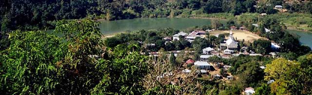
Lakes
Lakes are scattered all over the state. But the most important of them
are Palak, Tamdil, Rungdil; and Rengdil. The Palak lake is situated in
Chhimtuipui District in southern Mizoram and covers an area of 30 Ha.
It is believed the lake was created as a result of an earthquake or a
flood. The local people believe a village which was submerged still
remains intact deep under the waters. The Tamdil lake is a natural
lake situated 110/85 kms from Aizawl. Legend has it there was once a
huge mustard plant in this place. When the plant was cut off, jets of
water sprayed from the plant created a pool of water, and thus the
name Tamdil which means of 'Lake of Mustard Plant' was born. Today the
lake is an important tourist attraction and a holiday resort.
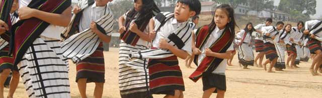
People
The inhabitants of Mizoram are known by the generic name of Mizo,
which literally means people (mi) of the hills (zo). There are a
number of separate tribes under the general ethnic broad group of Mizo.
Mizos included the following tribes - Ralte, Paite, Dulien, Poi, Sukte,
Pankhup, Jahao, Fanai (Molienpui), Molbem, Taute, Lakher, Dalang, Mar,
Khuangli, Falam (Tashous), Leillul and Tangur. The three main sub
groups are Lushais, Pawis and Lakhers. The fabric of social life in
the Mizo society has undergone tremendous changes over years. Before
the British moved into the hills, for all practical purposes the
village and the clan formed units of Mizo society. The Mizo code of
ethics or Dharma moved around 'Tlawmngaihna", an untranslatable term
meaning on the part of everyone to be hospitable, kind, unselfish and
helpful to others. They came under the influence of the British
Missionaries in the 9th century, and now most of the Mizos are
Christians. The Missionaries introduced the Roman script for the Mizo
language and formal education. The cumulative result is high
percentage 95 % (as per National Sample Survey 1997-98) which is
considered to be highest in India. Mizos are fast giving up their old
customs and adopting the new mode of life which is greatly influenced
by the western culture. Many of their present customs are mixtures of
their old tradition and western pattern of life. Music is a passion
for the Mizos and the young boys and girls take to the western music
avidly and with commendable skill. The fascinating hills and lakes of
Mizo-land literally pulsate and resound with the rhythms of the
sonorous songs of the youths and the twang of guitars everywhere.
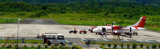
How to reach there
 |
|